Kumaon geography can be defined as bounded on the north by Tibet, on the east by Nepal, on the south by Uttar Pradesh, and by the Garhwal region of the state on its west. The Kumaon region consists of the Himalayas and two submontane strips, known as Terai, marshy lands, and Bhabar, dry lands. Till 1850, the submontane strips were covered by dense forests and abundant wildlife with sparse human occupation. Since then, the forests have been cleared, the land cultivated, and now these areas are fairly densely populated with several townships having grown.
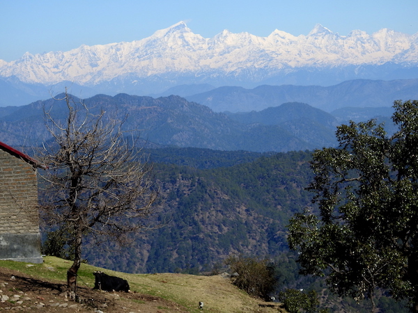
The Kumaon Himalayas are the west-central section of the Himalayas in northern India, extending about 320 km bounded by the Sutlej River and the Kali River. The range of mountains here are part of the Siwalik Range in the south and part of the Great Himalayas in the north. This area has more than 30 major peaks. Nanda Devi peak dominates this region, rising to 25,646 feet (7,817 metres) while Kamet peak at 25,446 feet (7,756 metres) is near the border with the Tibet Autonomous Region. Glaciers and snowmelt feed the headstreams of the Ganga and the rivers flow through gorges and steep ravines that have been carved out of the mounatins through centuries of time. Major rivers in the region originating from the Himalayan peaks are Goriganga, Dhauliganga, and Kali. Other rivers that flow through the region include Sharda separating Nepal from India, Pindar and Kaliganga.
The rock formations here mostly constitute sandstone, granite, limestone, slate and gneiss.
Geography of Kumaon ~ Climate: The weather varies considerably through the vastly different terrain of Kumaon, which ranges from the high Himalayas, the central region, and the plains. Mean temperatures for the region are meaningless because temperatures, climate, vegtation all differ considerably depending on the height which varies from sea level to well over 20,000 feet. The density of population, lifestyle, flora and fauna also vary vastly. Winter in the mountains is from October to February/March, and at some places it is extremely cold during this period. Snowfall is common at higher elevations. Monsoon strikes the outer Himalayan Range first, and this area receives almost double the amount of precipitation in the region of the central hills. The average annual rainfall in Kumaon is between 1000 and 2000 mm.
At elevations above 14,000 feet (4,300 metres), snow covers the mountains through the year. Between 9,000 and 14,000 feet, below the permanent snow line, is a windswept zone where sheep and goats are taken to graze during the the short summers, and which are the preferred areas for trekking between May and October. At lower elevations, between 3,500 and 9,000 feet, a temperate climate favours settlements; terraced slopes are cultivated and livestock reared.
This region is immensely rich in the variety of flora here, and there are some 4000 species of plants. There is a remarkable diversity in natural vegetation because of the range of elevation. The flora of this region may be classified as tropical, Himalayan sub-tropical, sub alpine and alpine vegetation. The alpine and sub alpine zones have a large number of medicinal plants.
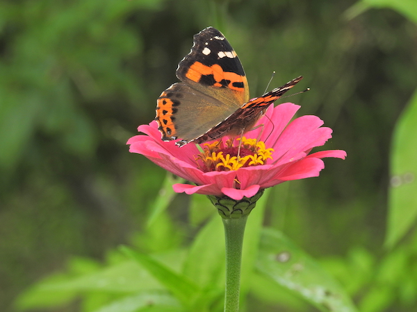
In Kumaon, among larger mammals, there are tigers, leopards, elephants, different kinds of deer, including musk deer, wild boar and bears. Snow leopard and blue sheep are found in higher regions. The variety of birds and butterflies in Kumaon are astounding.
Geography of Kumaon ~ trees: The sub-tropical region is between altitude of 300 m and 1500 m and trees here include sal, teak, shisham,haldu and other similar broad-leafed variety of trees. In the dry slopes between 1200 to 1800 m there is an abundance of chir and other pines. Between 1500 and 1800 m, forests are of chir pine, baanj or oak, while in the sub-tempearte regions between 1800m and 2800 m, deodar or Himalayan cedar, utis, horse chestnut, banj oak, rianj oak, tilonj oak, Himalayan (blue) pine, silver fir, spruce, chestnut, elm, poplar, birch, yew, cypress, and rhododendrons grow. Between 2800 to 3800 m altitude,bhoj patra, betula utilis, kharsu oak, and silver fir are found. At higher altitudes between 3800 and 5000 m altitude, shrubs and grassy meadows dominate.